Population 10 Billion - Materials
On this page you can find material from the book Population 10 Billion. To find out more about the book, please go to the overview.
Sample pages
- Book cover [PDF: 272.4 KB]
- Contents [PDF: 39.2 KB]
- Extract from Chapter 1 [PDF: 398.4 KB]
Reviews / Comments
- Population 10 Billion by Danny Dorling - review (The Guardian, 16 June 2013)
- A global population of 10 billion is nothing to worry about (The Guardian, 14 June 2013)
- Some Good News - World Population Day (Huffington Post, 8 July 2013)
Audio and Video
Danny widely discussed his book in the media. Here is a selection of it:
Ageing China: What are the challenges facing the country's rapidly ageing population?
- Ageing China (Al Jazeera Inside Story, 3rd July 2013, see above) - show online stream
- Today [MP3: 4.3 MB] (BBC Radio 4, 20th June 2013)
- Newsday [MP3: 2.6 MB] (BBC World Service, 20th June 2013)
- Midori House [MP3: 5.6 MB] (Monocle Radio, 21st June 2013)
- Weekend [MP3: 7.3 MB] (BBC World Service, 23rd June 2013)
- Nightwaves (BBC Radio 3, 20th June 2013)
Danny has also given many talks and lectures that are related to the subject:
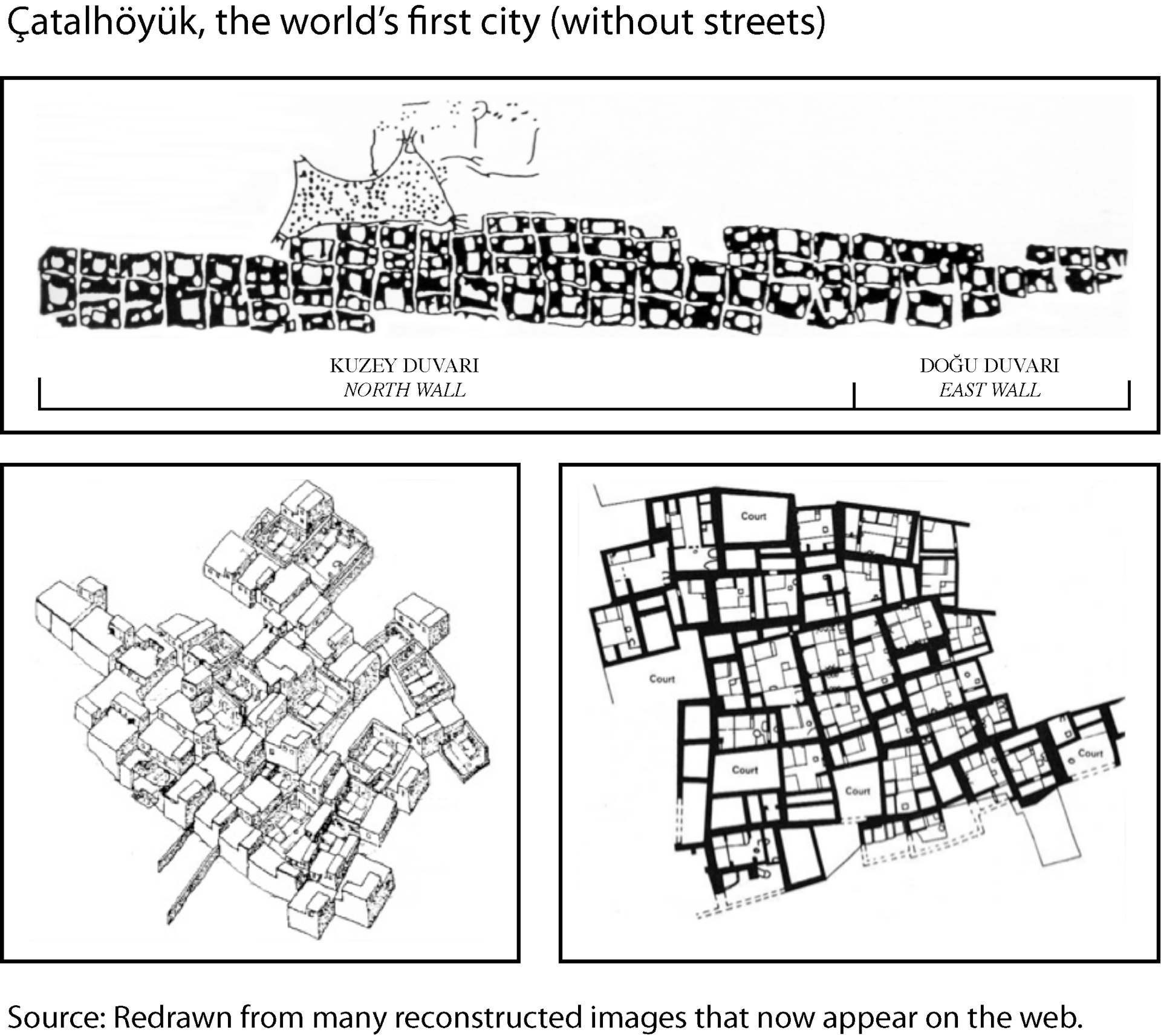
- From cities with no streets to vertical gardens MP3 Audio recording of a lecture at Sheffield University Architecture Society, University of Sheffield, 14th February 2013
- Can the planet support 10 billion people? MP3 Audio recording from an invited talk at the Sheffield and Rotherham Green Party AGM, St Mary's Church, Sheffield, 12th December 2012
- Is more equal more green? Interactive multimedia version of the Monday night lecture at the Royal Geographical Society, London,17 May 2010
Find more of Danny's talks on audioBoom and more videos can be viewed on Danny's website.
Graphics and Visualisations
The original figures from book can be viewed below.
The image shown on the overview shows the Earth at Night projected on an equal population map that gives every person on the planet an equal amount of map space. It highlights the existing inequalities that become visible in our night skies, with some of the world's population having poor access to electricity that allows them to pollute the night skies with light. The map has been drawn by Benjamin Hennig and is explained in further detail and shown in high resolution on his website.
Ben has also created a novel World Population Atlas using the same mapping technique. It shows the countries of the world in their real size and shapes according to the population distribution. The page also gives an overview of the estimated population changes for each country in an interactive population cartogram.
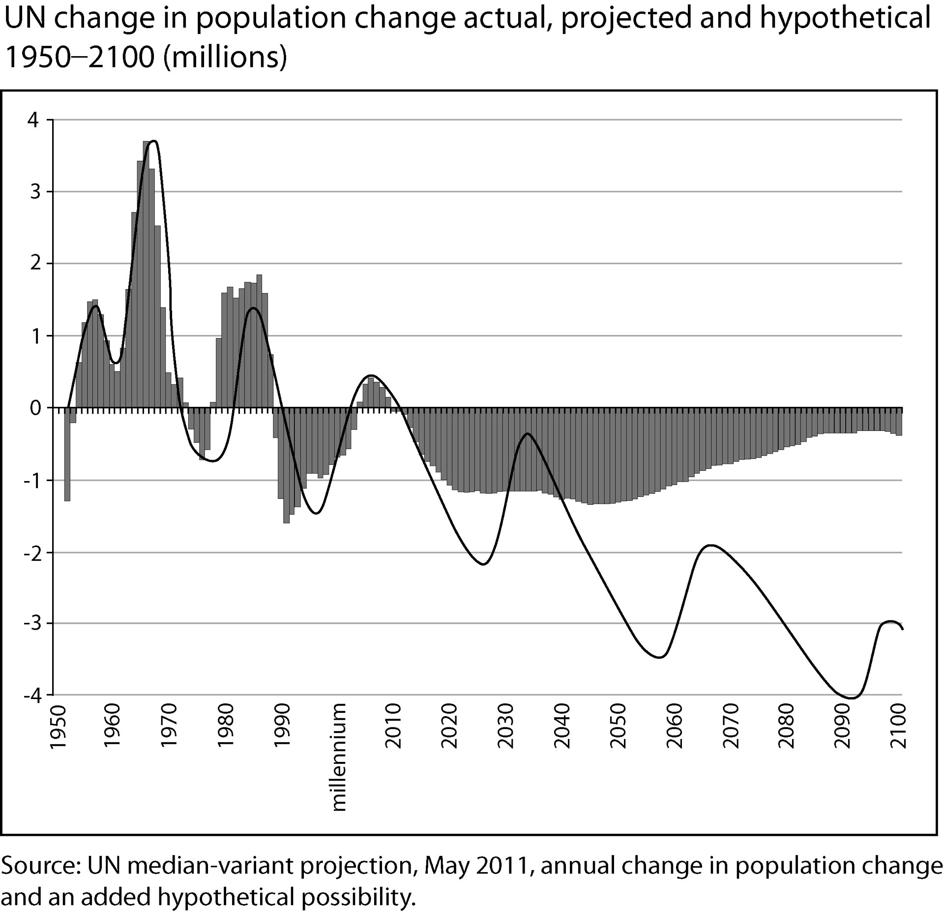
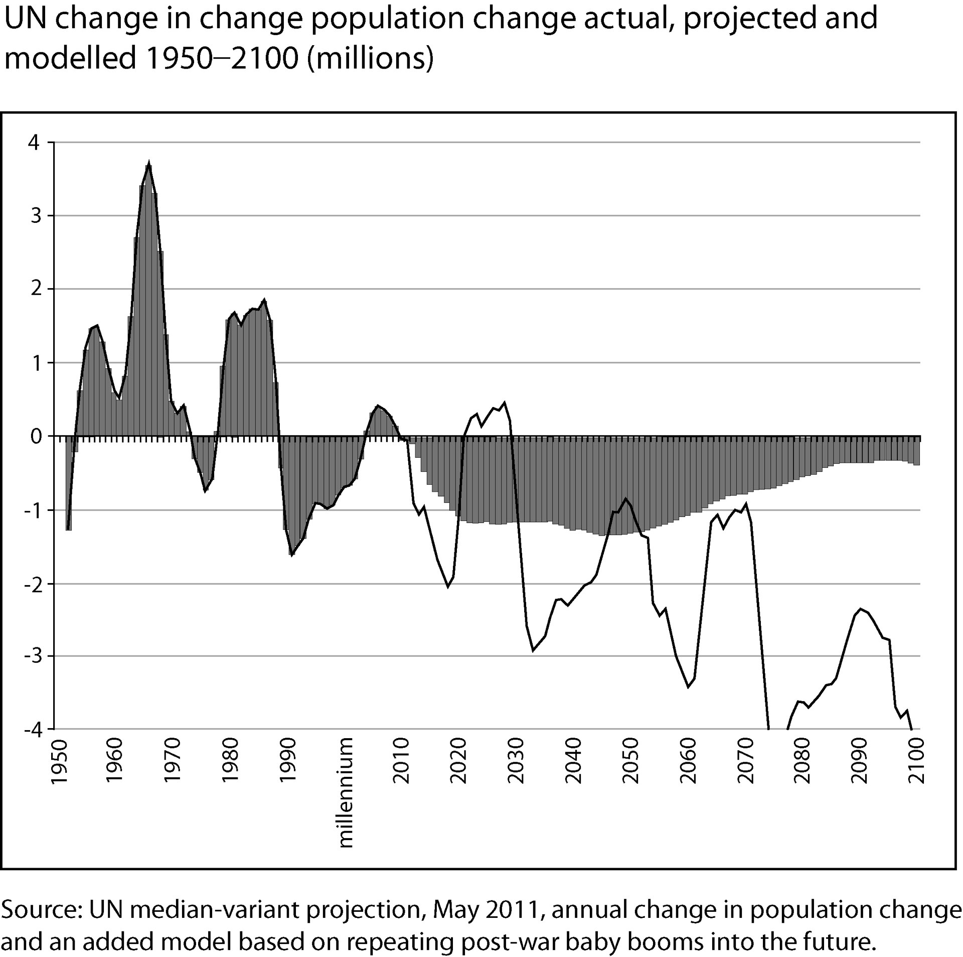
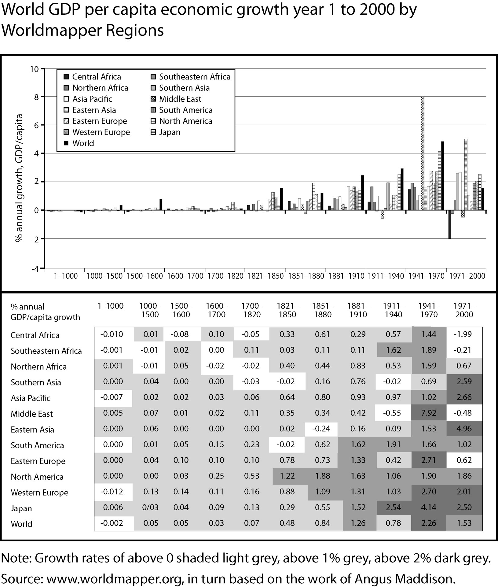
Figures
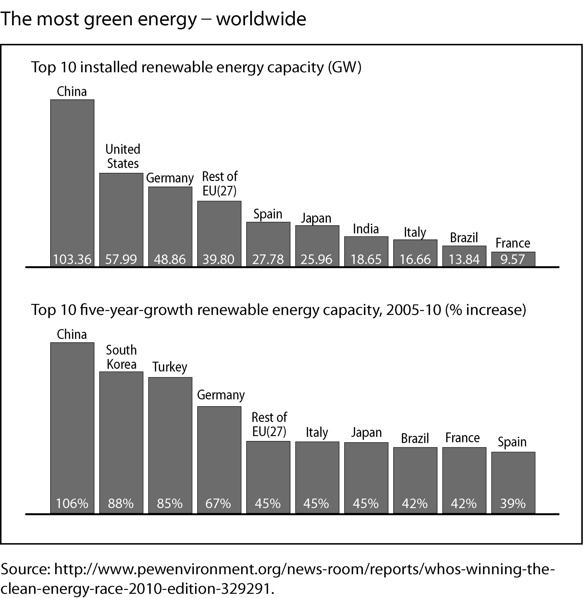
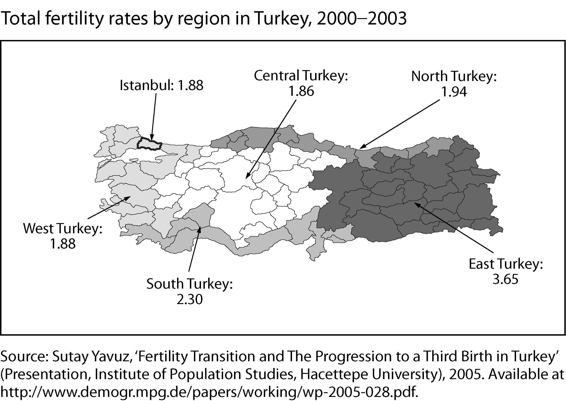
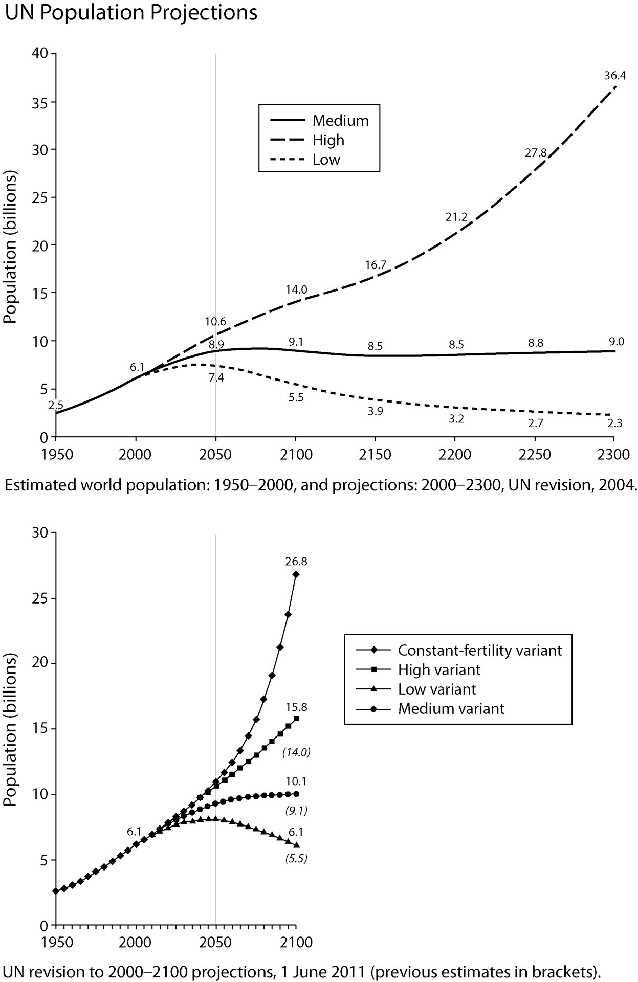
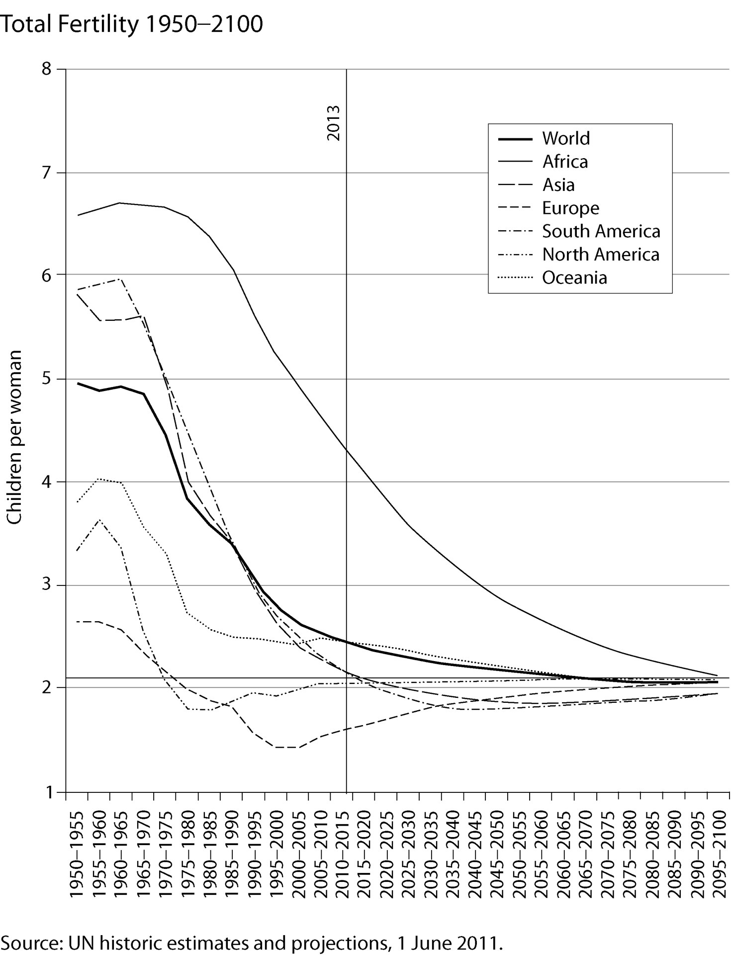
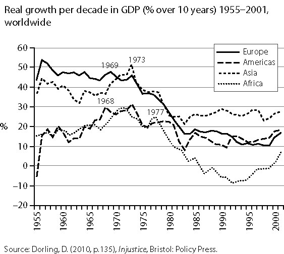
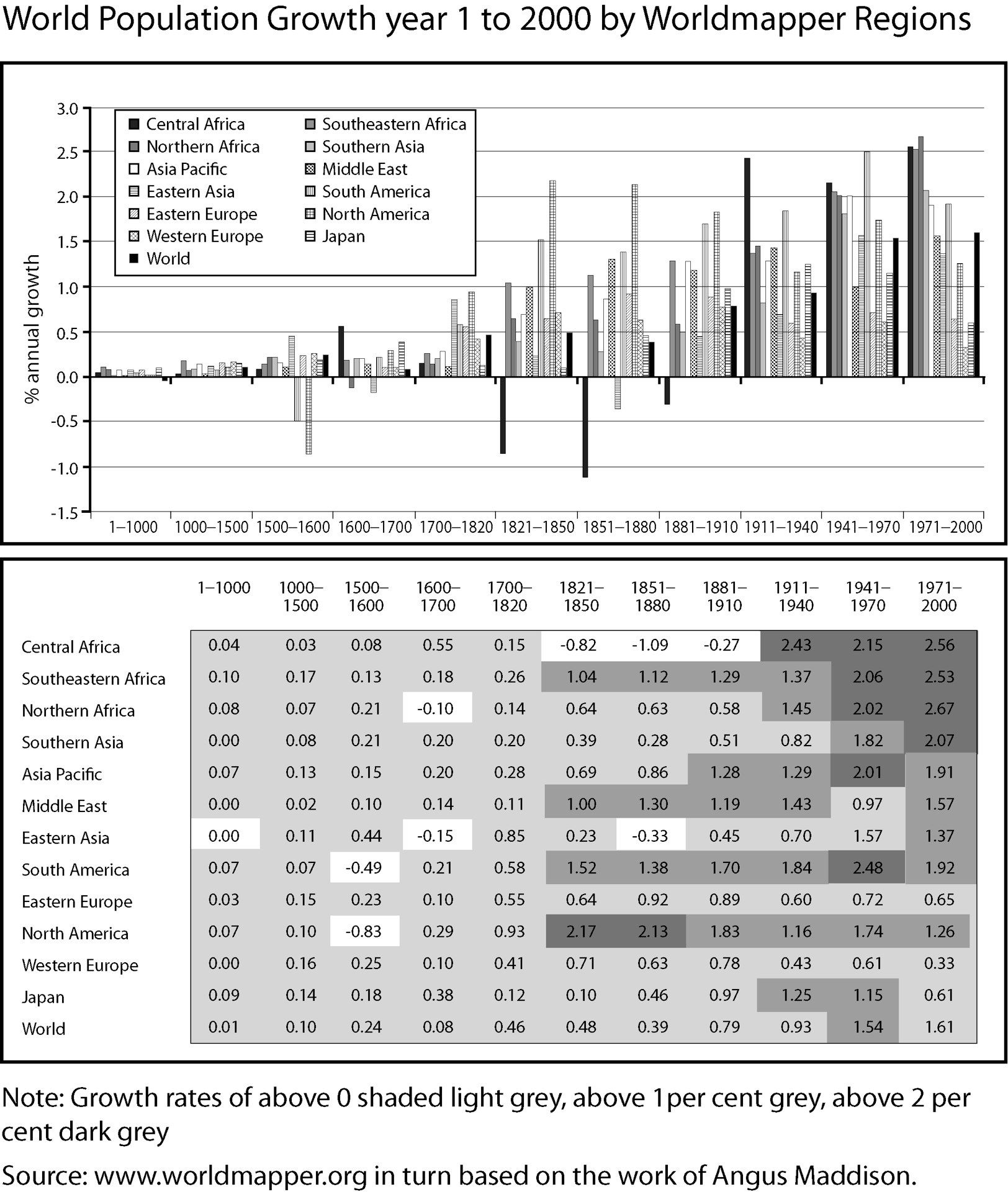
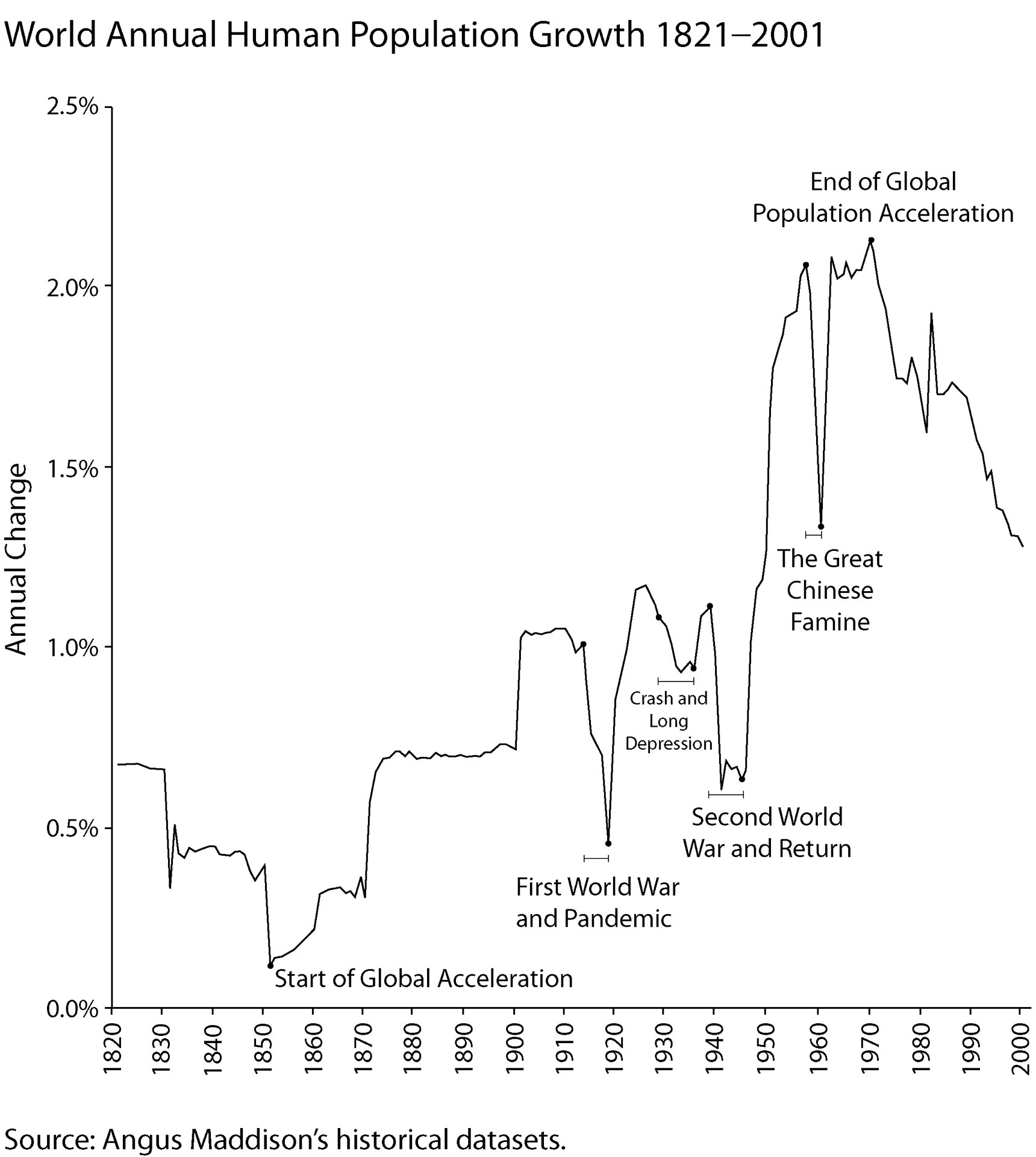
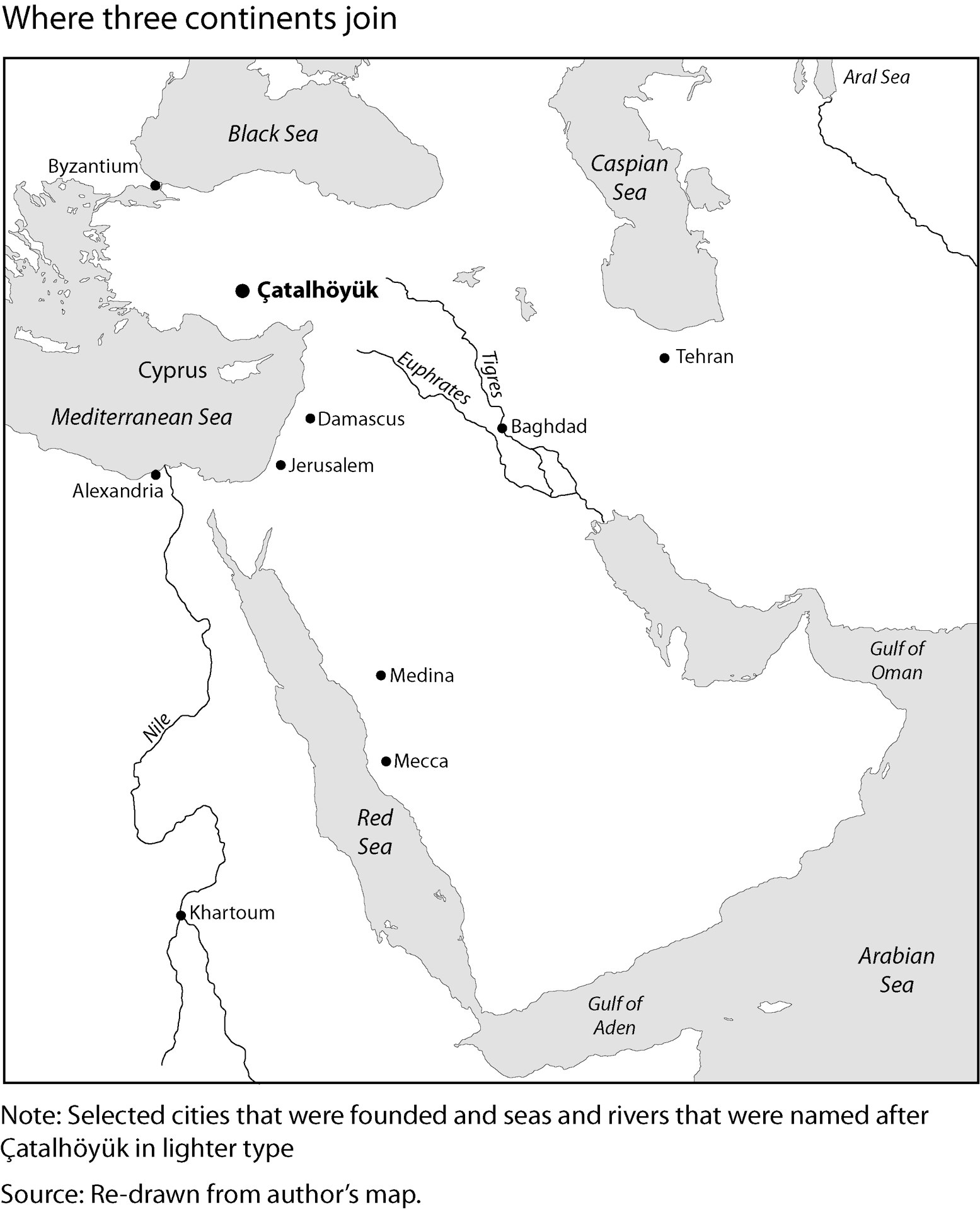
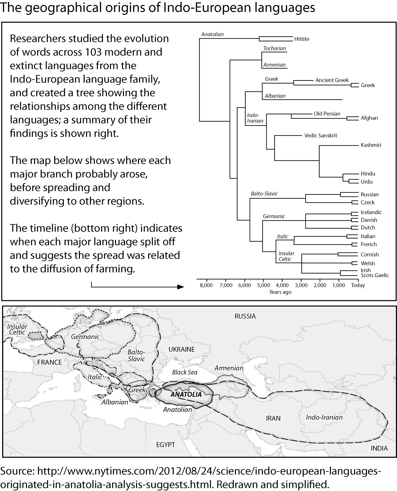
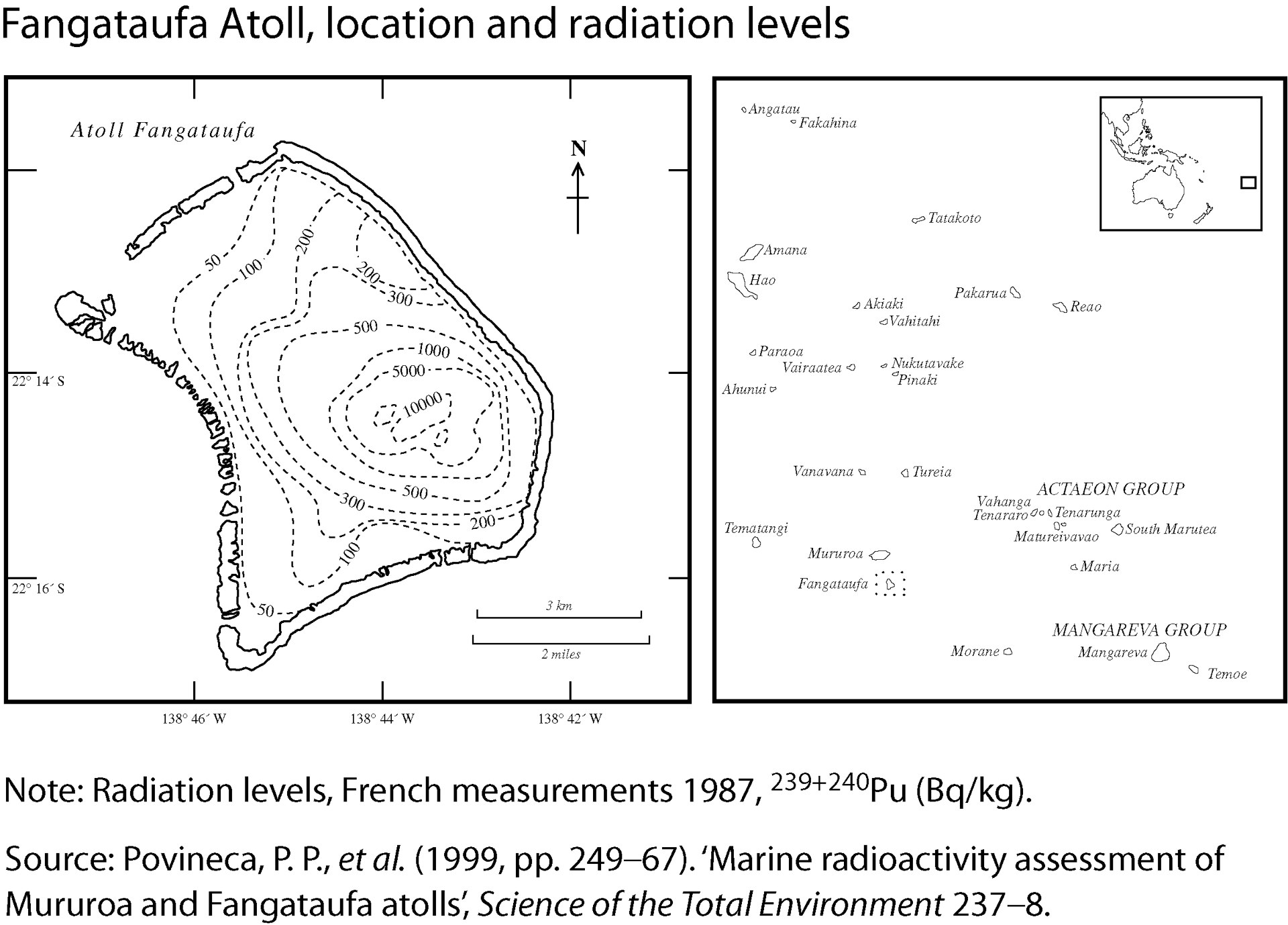
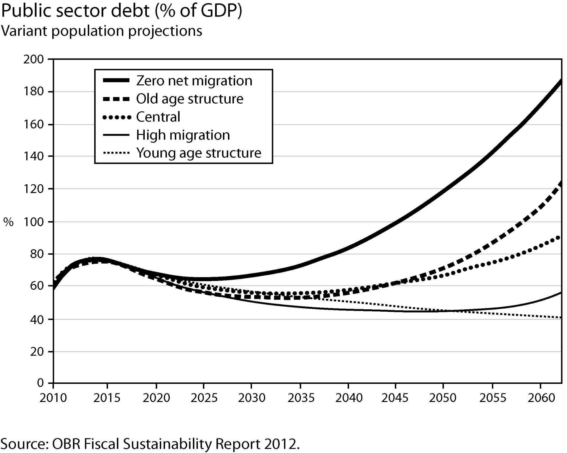
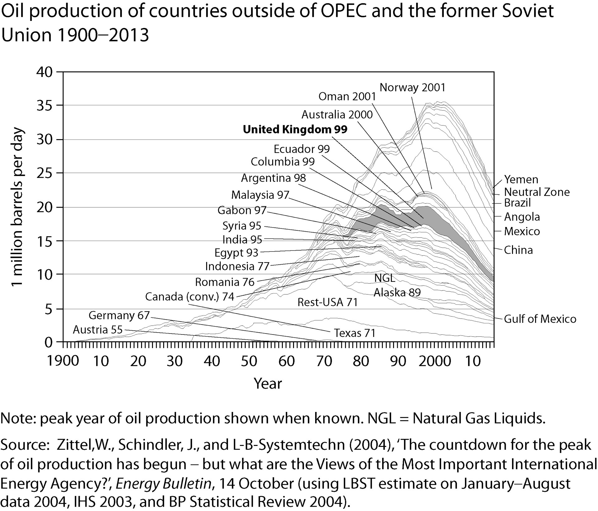
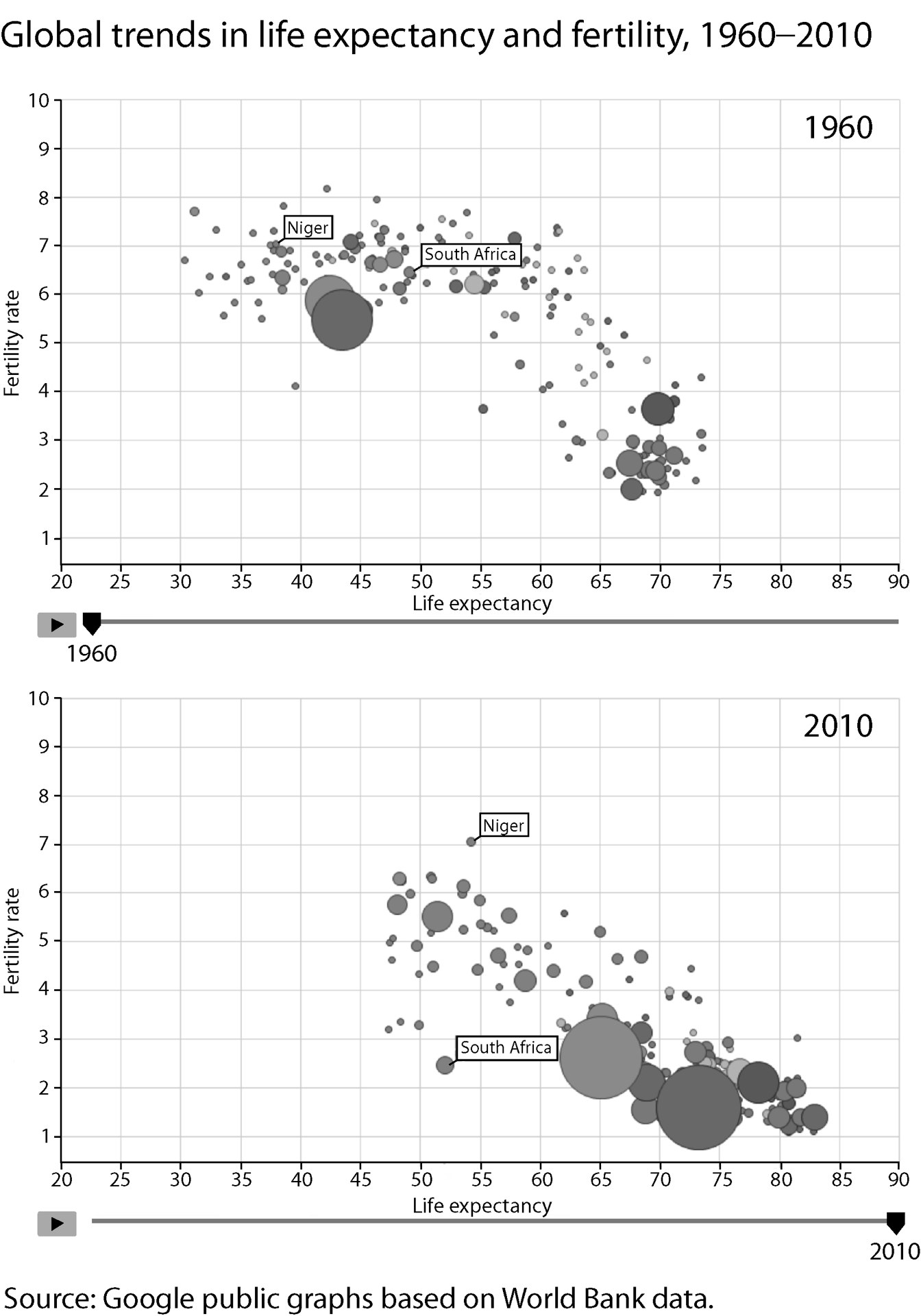
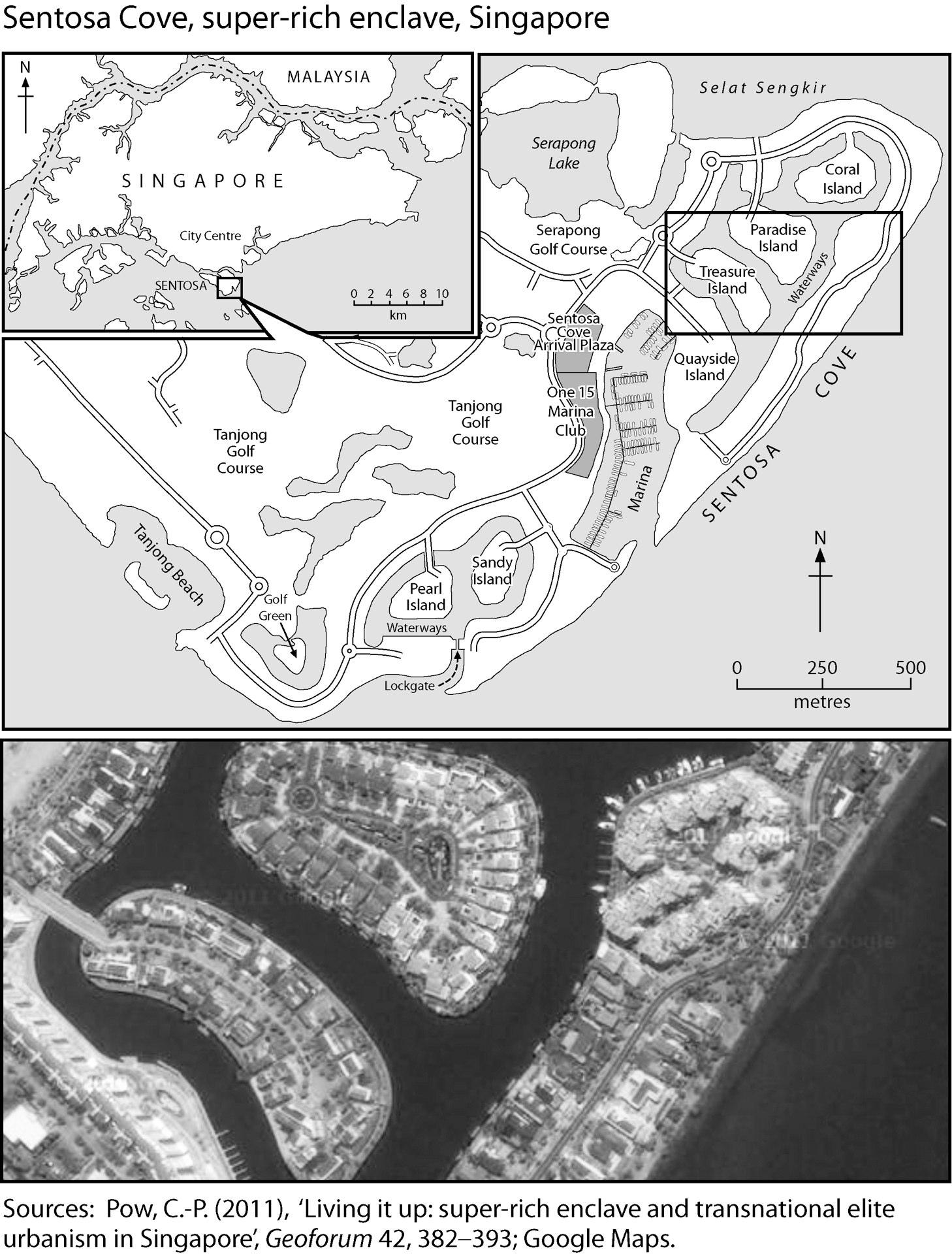
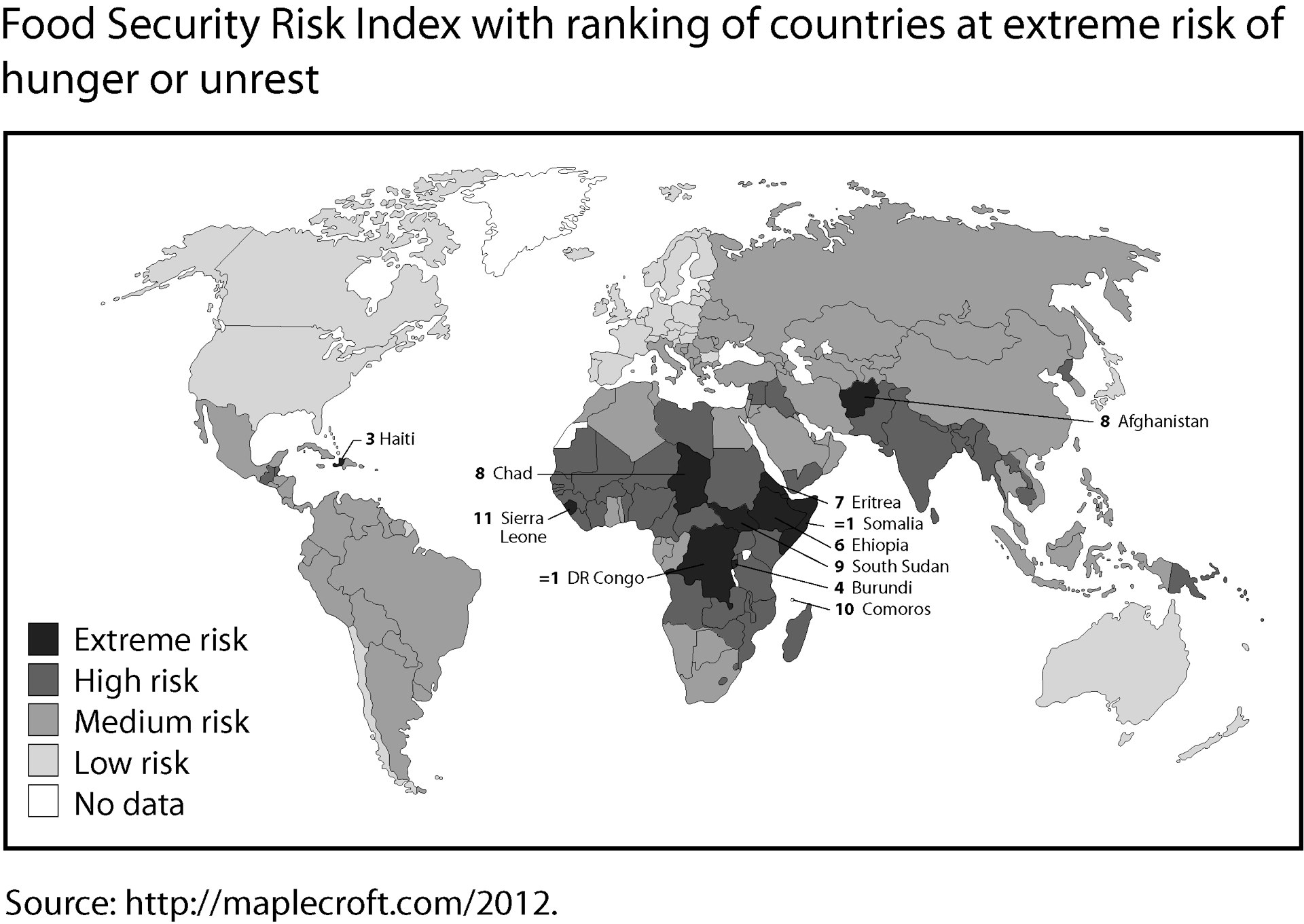
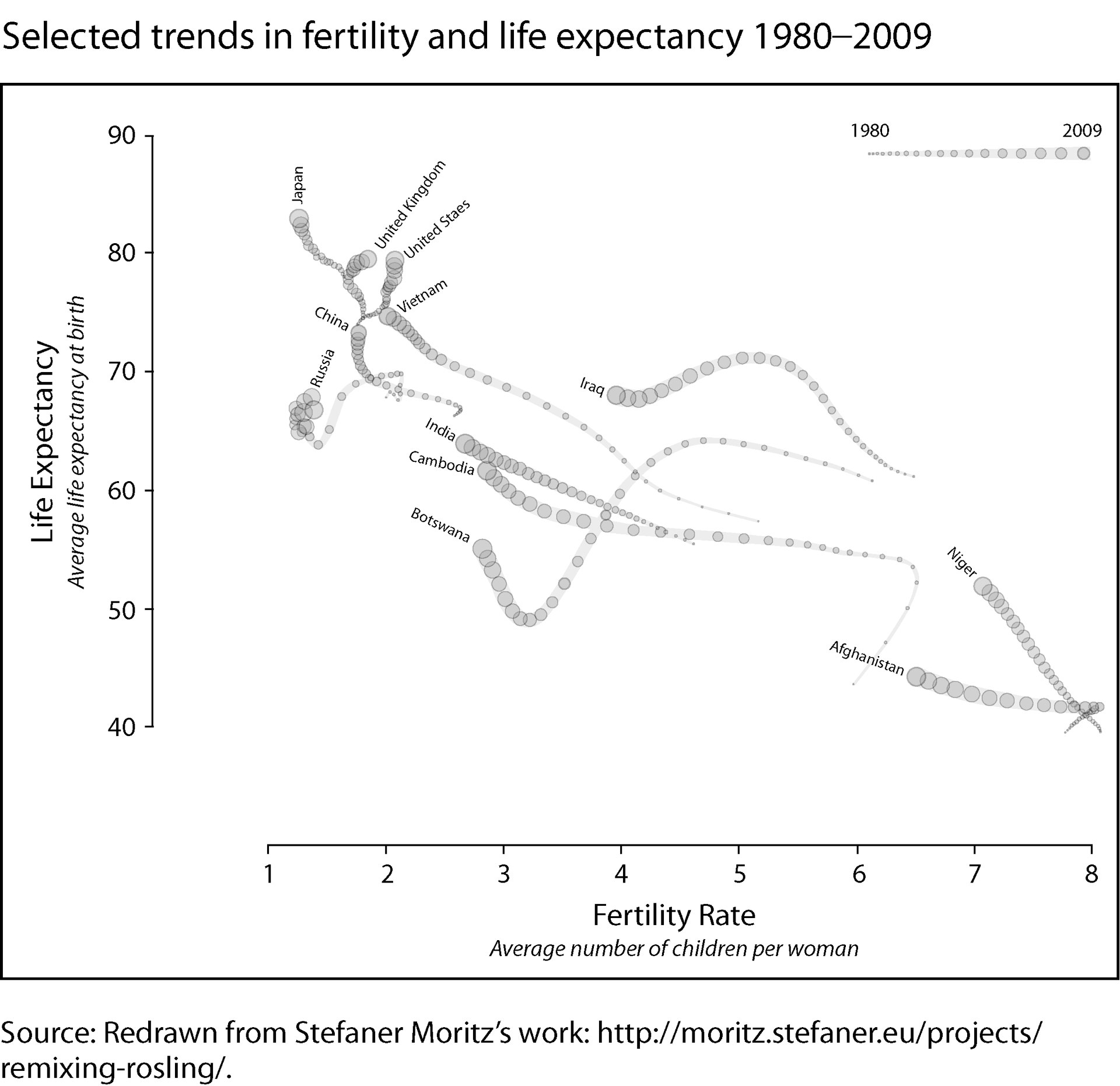
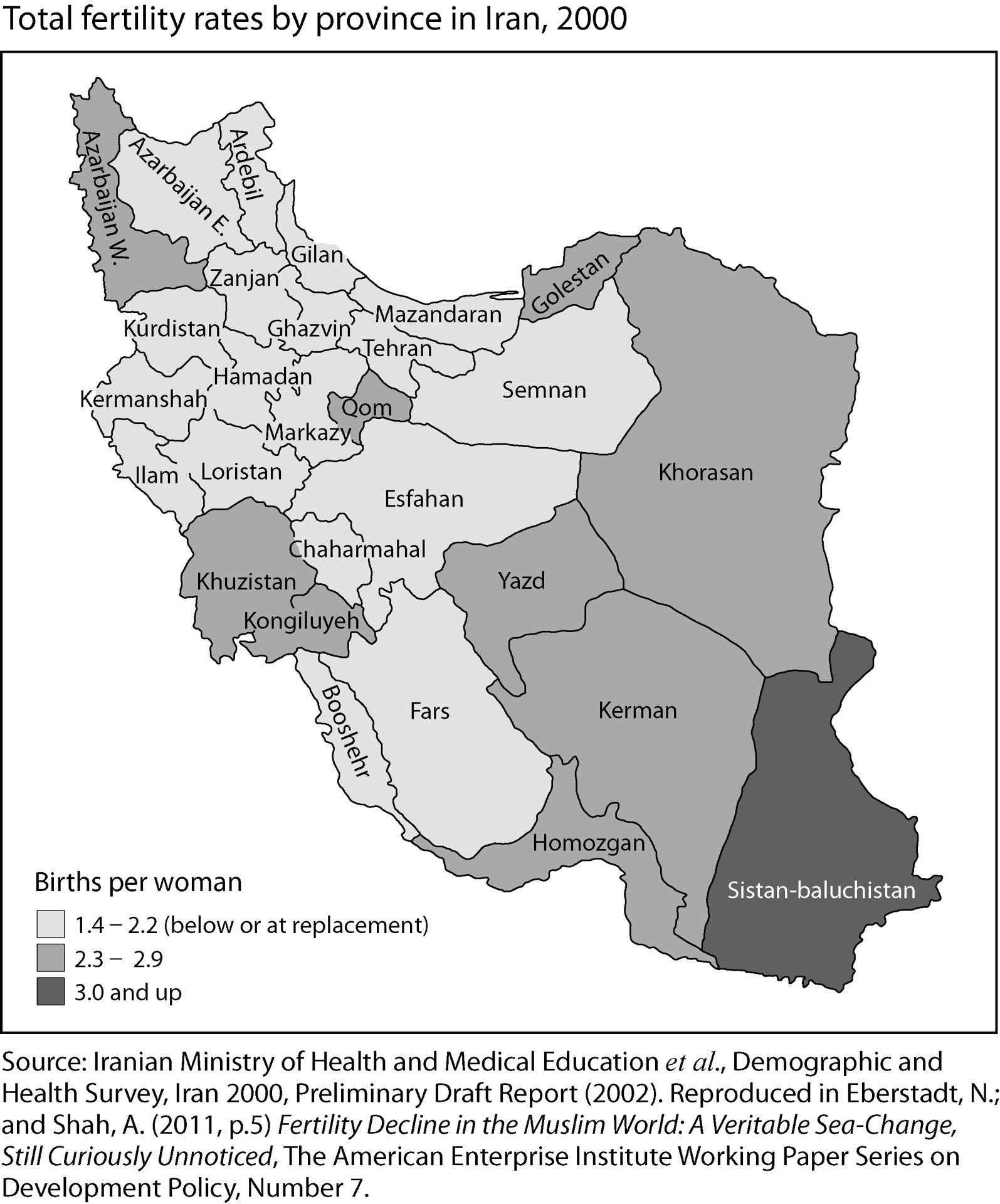
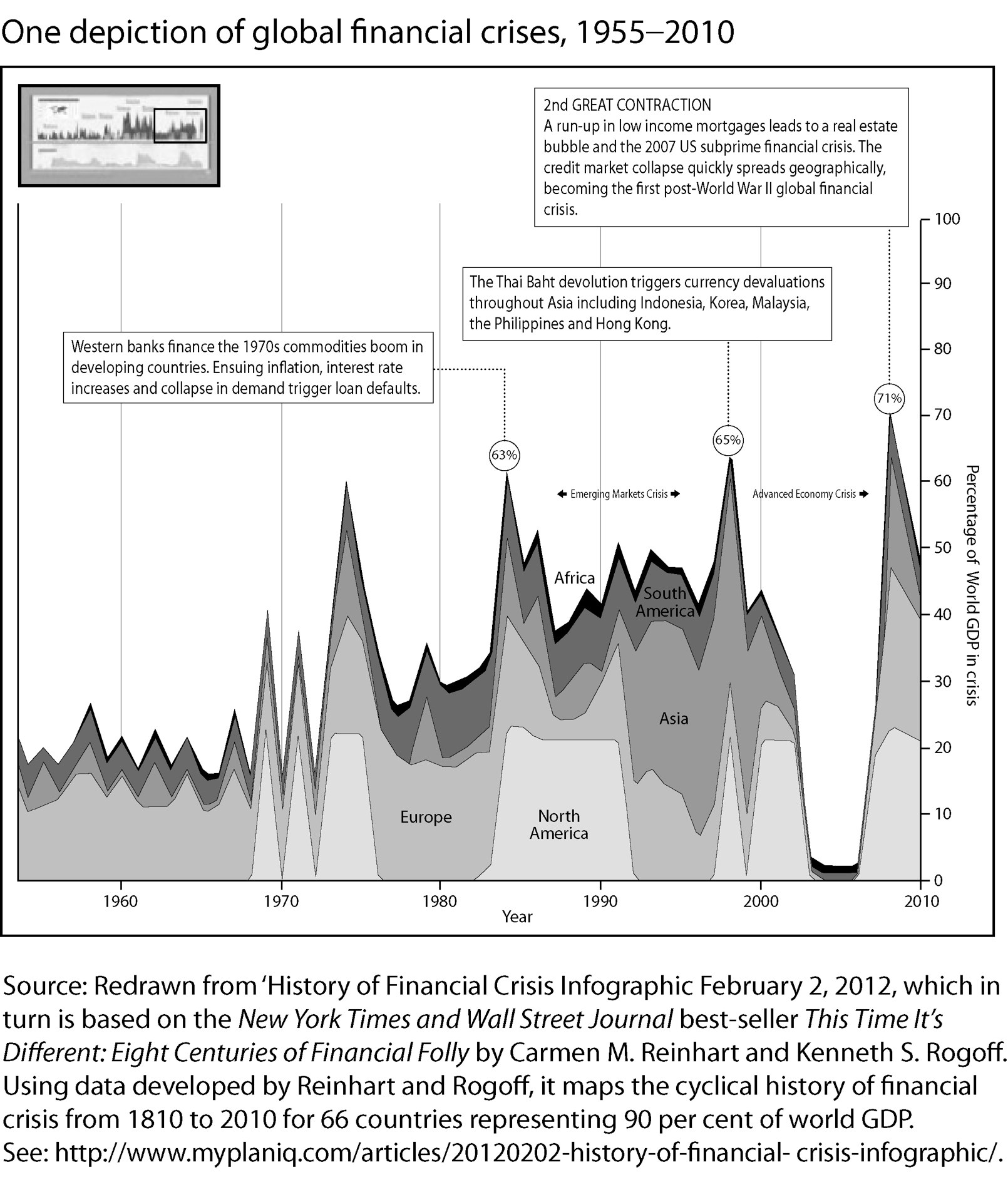
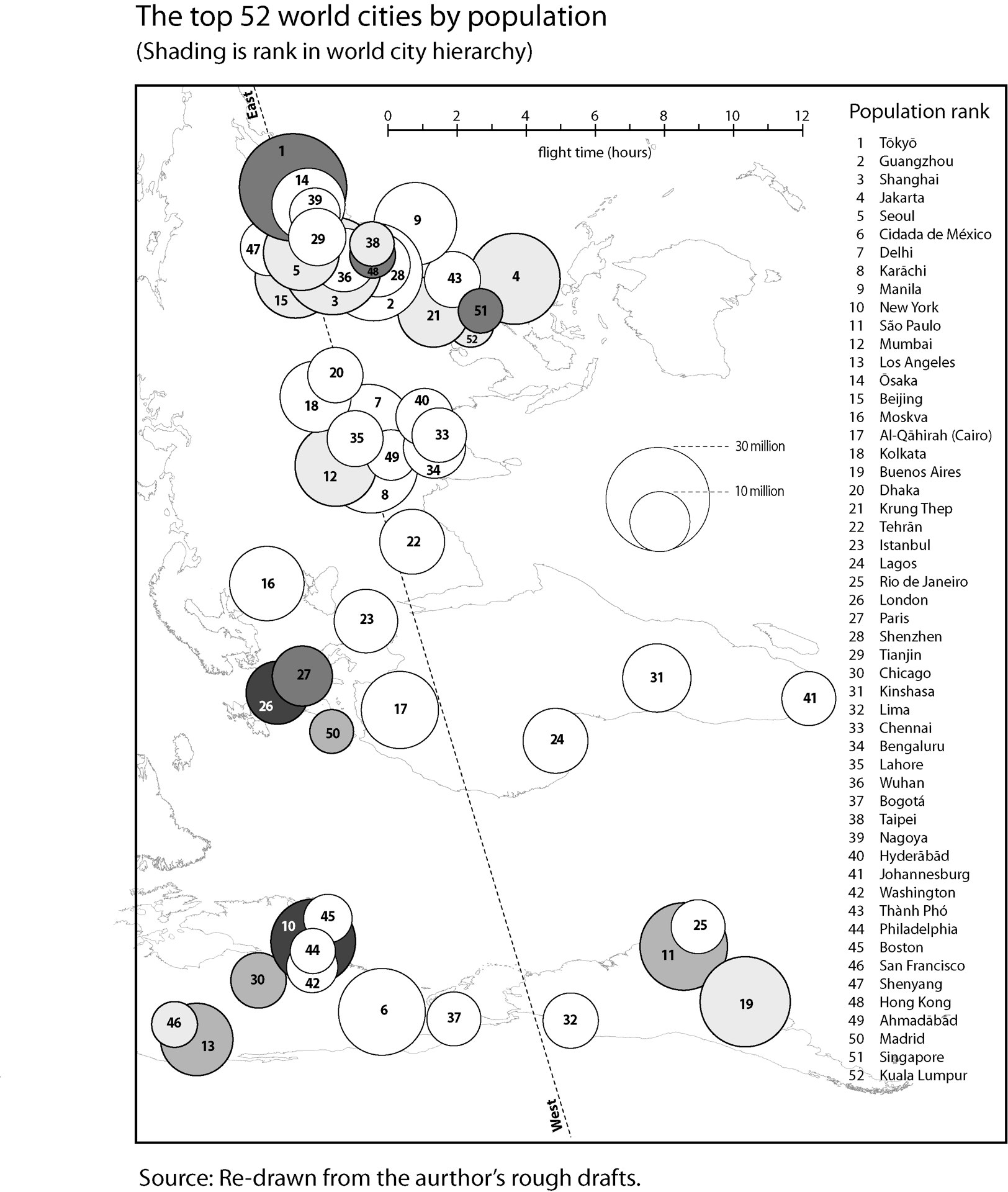
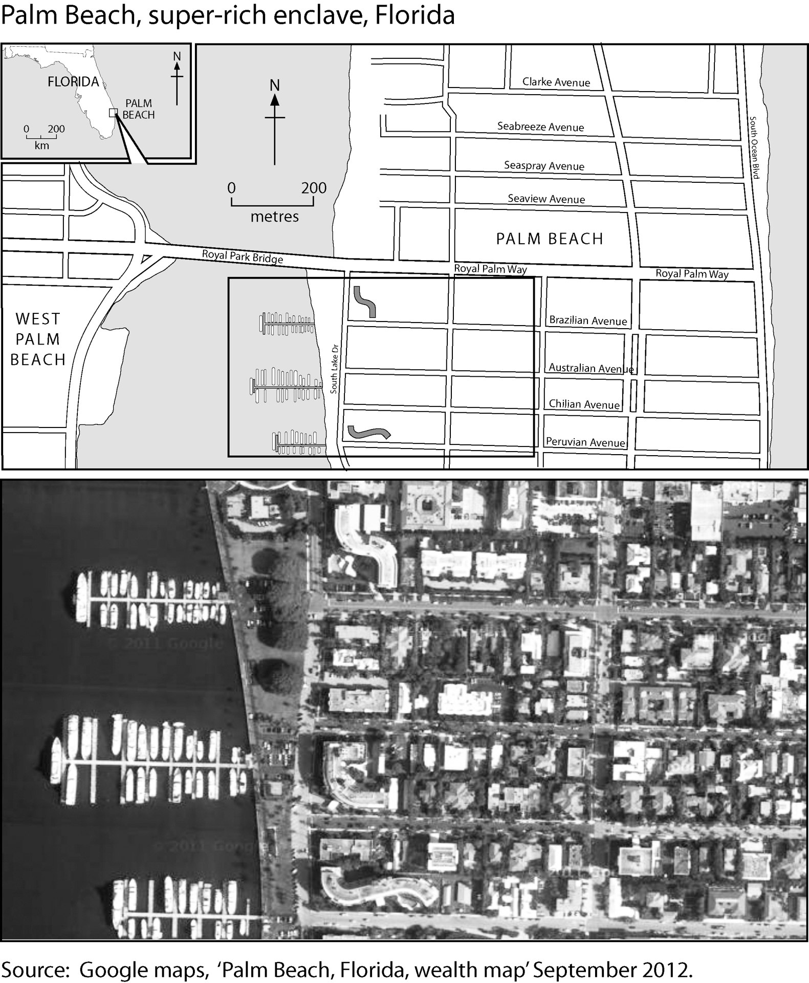
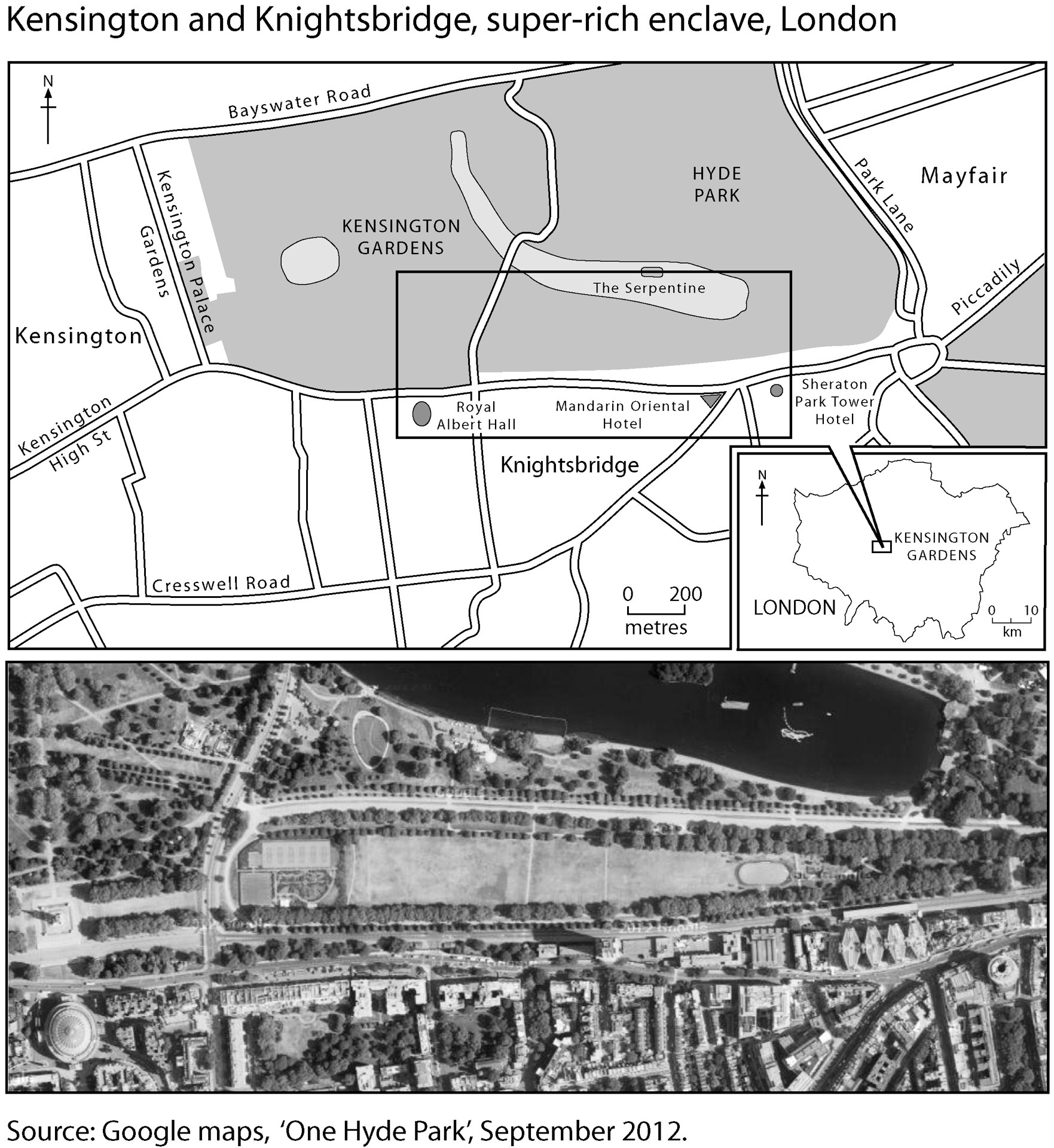
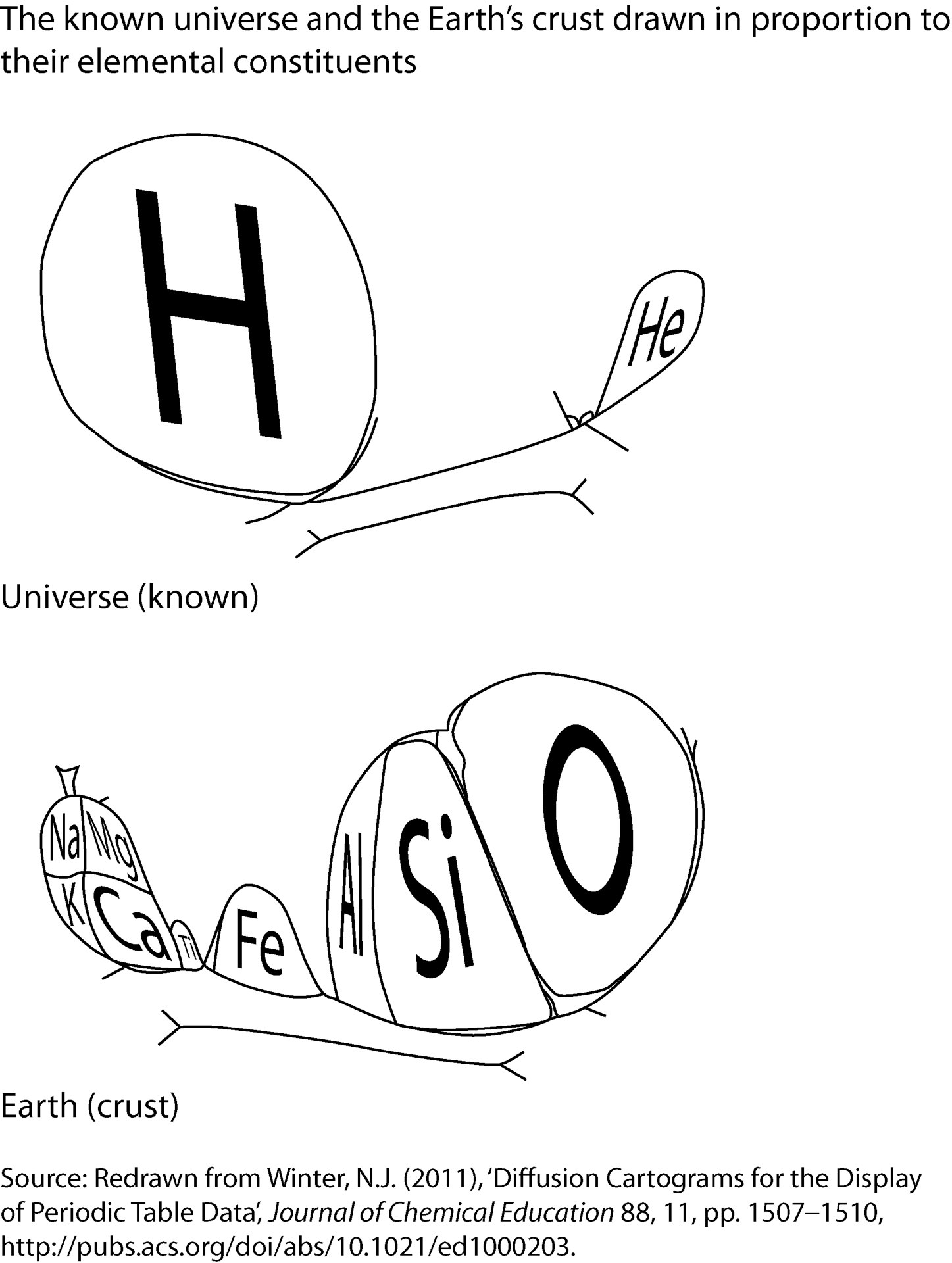
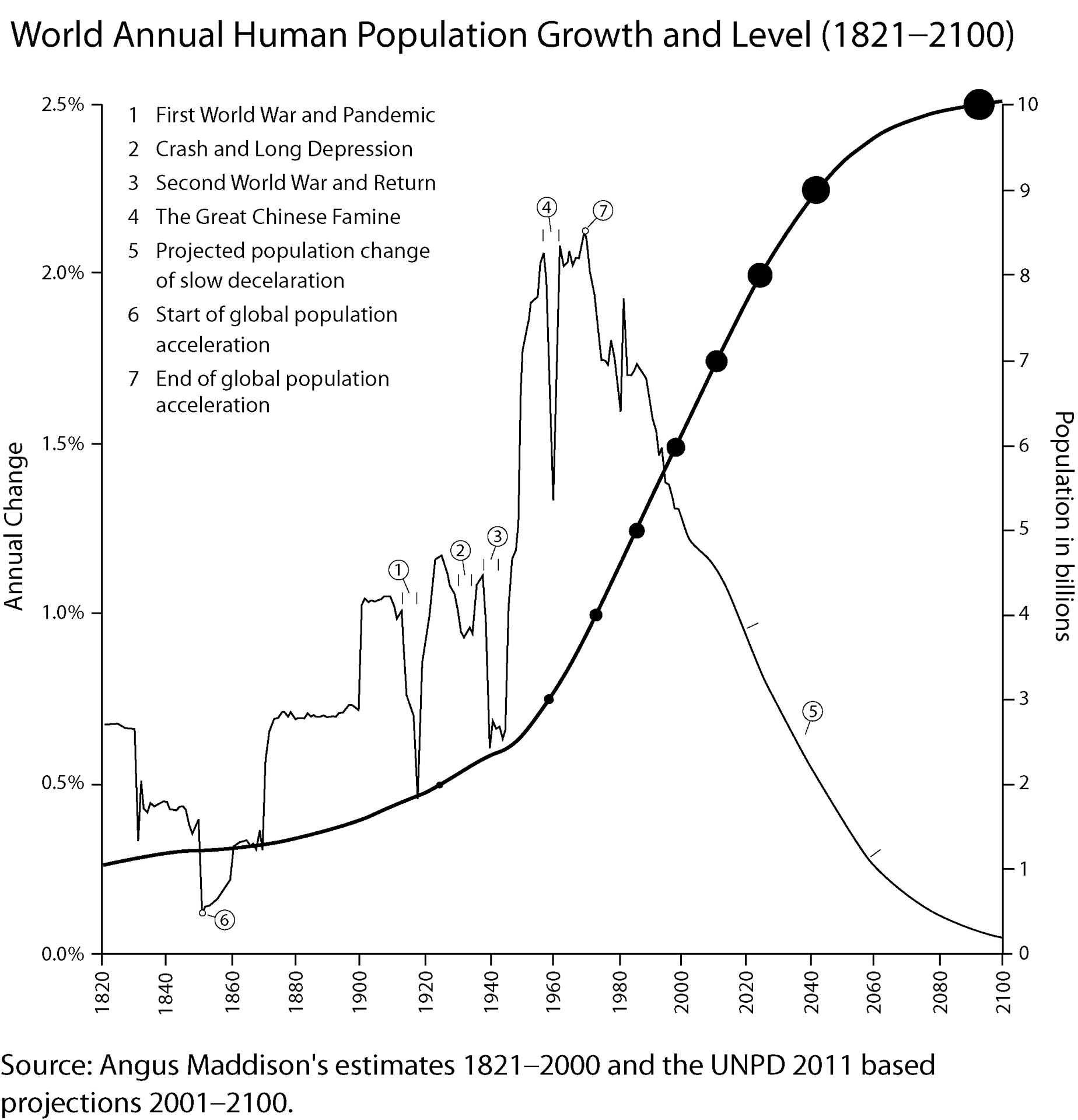
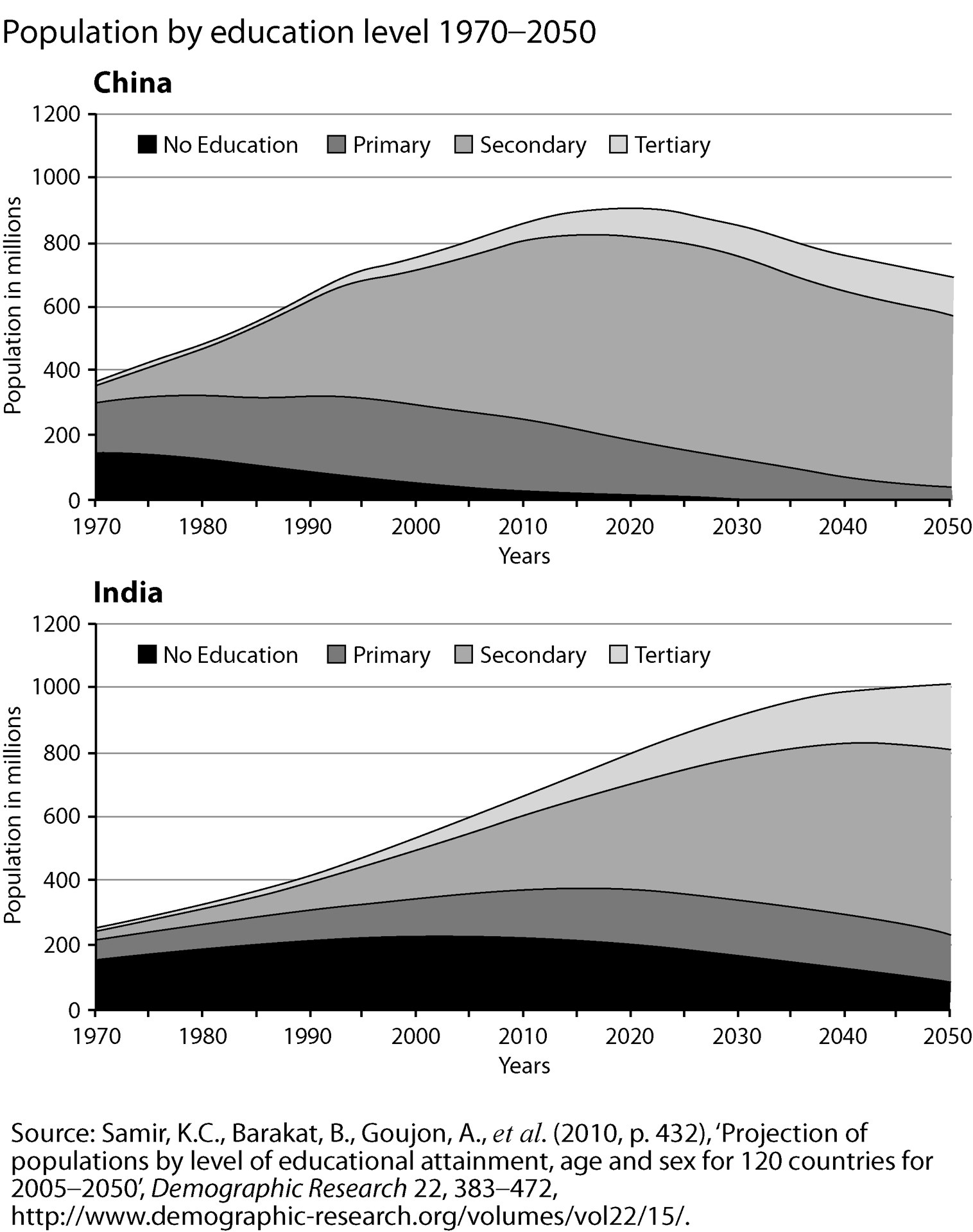
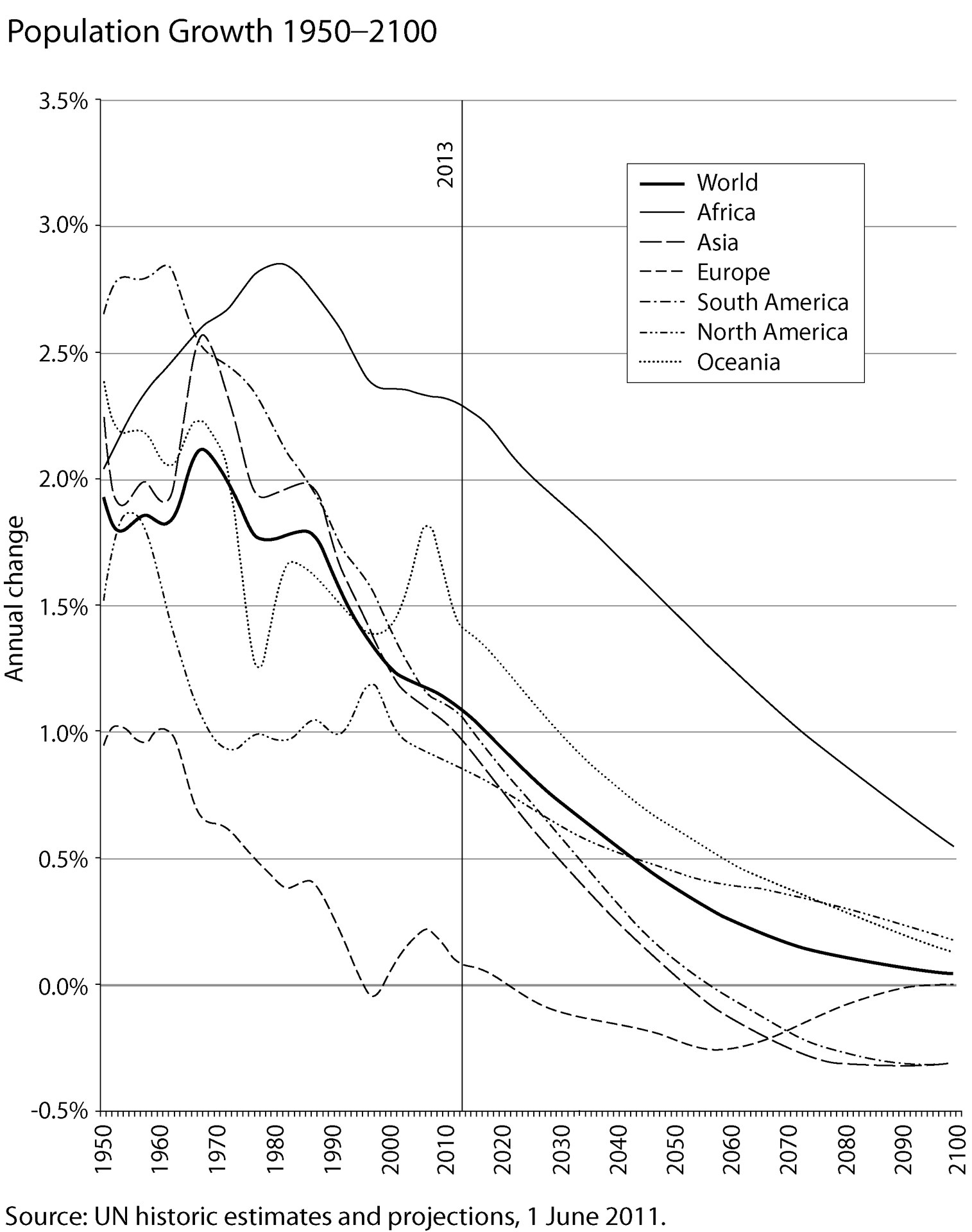
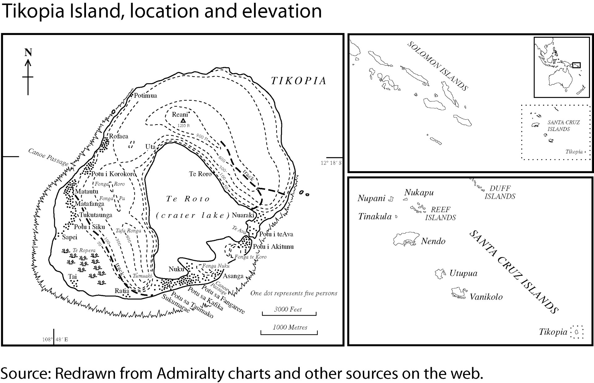
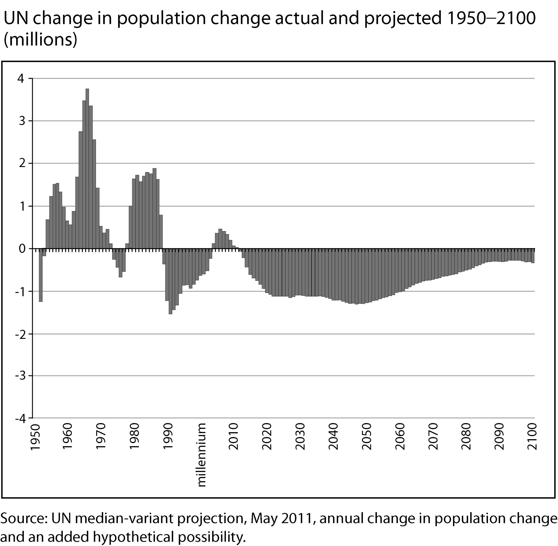
A full gallery of all graphs, images and tables featured in the book. Please click the preview images below for a larger version.


Back to Population 10 Billion. Back to Geovisualization, Inequality and Space Books.
To find out more about Danny and his work, please go to: www.dannydorling.org or view his staff webpage.