Associate Professor in Physical Geography
- Fellow and Tutor at Worcester College, Oxford
- Affiliated Researcher, Center for Ocean Solutions, Stanford University
- Member of the Biodiversity, Ecosystems and Conservation research cluster
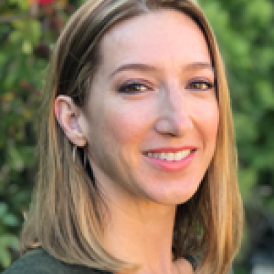
Dr Lisa Wedding is an Associate Professor in Physical Geography and a Tutorial Fellow of Worcester College, Oxford. Prior to April 2019, she held a Research Associate position at the Center for Ocean Solutions, Stanford University, and was a Postdoctoral Research Scholar at the University of California at Santa Cruz, USA.
Lisa has a special interest in applying a geospatial approach at the intersection of science and policy to solve environmental problems. Her overall approach to research and problem solving weaves together theoretical approaches from the disciplines of landscape ecology, conservation biology and applies geospatial analytical tools and techniques. Lisa’s applied seascape ecology research has focused on field-based ecological data collection and spatial modeling efforts in both tropical and temperate marine environments. Her current research is focused on combining remote sensing and analytical tools to track rapid change in these marine regions, in order to help identify risks of potential tipping points and illuminate ocean policy solutions.
Lisa has a special interest in teaching an applied geospatial approach to problem solving in natural resource management using inquiry-based teaching methods. At Worcester College, she is responsible for teaching students physical geographical topics for the Preliminary Examination and Final Honour School of Geography.
Undergraduate
Geospatial Field Methods Course – Lisa has created the geospatial curriculum for a one-month intensive field marine ecology course at the Hawaii Institute of Marine Biology. She has spent the last decade teaching undergraduates how to use GPS, plan a field sampling design using benthic habitat maps, manage data in GIS (Geographic Information Systems), collect remotely sensed data, conduct spatial analysis and create map products for scientific reporting.
Academic Advising
At SoGE, Lisa will be leading research in each of these sub-themes:
- Integrating landscape ecology and remote sensing to support spatially predictive modeling and mapping of key resource species.
- Applying remote sensing to illuminate climate change effects on coastal social-ecological resilience and tipping points.
- Linking geospatial data science to high seas and open ocean policy and governance solutions.
She welcomes enquiries from individuals wishing to undertake doctoral or post-doctoral research in the following themes: spatial ecology, seascape ecology, conservation biology, remote sensing, and linking geospatial science to policy.
Current Graduate Research Students
Pirta Palola | Towards integrated land-sea management: mapping and modelling ecological connectivity in tropical coastal environments |
For a full list of Lisa's publications please see Google Scholar, Academia, and ResearchGate.
Journal Articles
- Malhi, Y., Lander, T., le Roux, E., Stevens, N., Macias-Fauria, M., Wedding, L., Girardin, C., Kristensen, J.A., Sandom, C.J., Evans, T.D., Svenning, J.C. and Canney, S. (2022) The role of large wild animals in climate change mitigation and adaptation. Current Biology, 32(4). R181-R195.
- Lepczyk, C.A., Wedding, L.M., Asner, G.P., Pittman, S.J., Goulden, T., Linderman, M.A., Gang, J. and Wright, R. (2021) Advancing Landscape and Seascape Ecology from a 2D to a 3D Science. BioScience. biab001.
- Wedding, L.M., Moritsch, M., Verutes, G., Arkema, K., Hartge, E., Reiblich, J., Douglass, J., Taylor, S. and Strong, A.L. (2021) Incorporating blue carbon sequestration benefits into sub-national climate policies. Global Environmental Change. 102206.
- Aeby, G.S., Howells, E., Work, T., Abrego, D., Williams, G.J., Wedding, L.M., Caldwell, J.M., Moritsch, M. and Burt, J.A. (2020) Localized outbreaks of coral disease on Arabian reefs are linked to extreme temperatures and environmental stressors. Coral Reefs: 1-18.
- Chung, A., Wedding, L.M., Green, A.L., Friedlander, A.M., Goldberg, G., Meadows, A. and Hixon, M.A. (2019) Building Coral Reef Resilience Through Spatial Herbivore Management. Frontiers in Marine Science, 6.
- Jouffray, J.B., Wedding, L.M., Norström, A.V., Donovan, M.K., Williams, G.J., Crowder, L.B., Erickson, A.L., Friedlander, A.M., Graham, N.A.J., Gove, J.M., Kappel, C.V., Kittinger, J.N., Lecky, J., Oleson, K.L.L., Selkoe, K.A., White, C., Williams, I.D. and Nyström, M. (2019) Parsing human and biophysical drivers of coral reef regimes. Proceedings of the Royal Society B: Biological Sciences, 286(1896).
- Reiblich, J., Hartge, E., Wedding, L.M., Killian, S. and Verutes, G.M. (2019) Bridging Climate Science, Law, and Policy to Advance Coastal Adaptation Planning. Marine Policy, 104: 125-134.
- Wedding, L.M., Jorgensen, S., Lepczyk, C. and Friedlander, A.M. (2019) Remote Sensing of Three-dimensional Coral Reef Structure Enhances Predictive Modeling of Fish Assemblages. Remote Sensing in Ecology and Conservation.
- Wedding, L.M., Lecky, J., Gove, J.M., Walecka, H., Donovan, M.K. et al. (2018) Advancing the Integration of Spatial Data to Map Human and Natural Drivers on Coral Reefs. PLoS One, 13(3).
- Wedding, L.M., Reiter, S., Hartge, E. et al. (2018) Values at the Land-Sea Interface: Mapping Coastal Ecosystem Services in a Changing Climate. Current: The Journal of Marine Education.
- Mach, M.M., Wedding, L.M., Reiter, S.M., Micheli, F., Fujita, R.M. and Martone, R.G. (2017) Assessment and Management of Cumulative Impacts in California's Network of Marine Protected Areas. Ocean and Coastal Management, 137(1): 1-11.
- Reiblich, J., Wedding, L.M. and Hartge, E. (2017) Enabling and Limiting Conditions of Coastal Adaptation: Local Governments, Land Uses and Legal Challenges. Ocean and Coastal Law Journal, 22(2).
- Reineman, D., Wedding, L.M., Hartge, E., McEnery, W. and Reiblich, J. (2016) Coastal Access Equity and the Implementation of the California Coastal Act. Stanford Environmental Law Journal 89, 36.
- Wedding, L.M., Maxwell, S.M., Hyrenbach, D., Dunn, D.C., Roberts, J.J., Briscoe, D., Hines, E. and Halpin, P.N. (2016) Geospatial Approaches to Support Pelagic Conservation Planning and Adaptive Management. Endangered Species Research, 30: 1-9.
- Jouffray, J.B., Nystrom, M., Norstrom, A., Williams, I., Wedding, L.M., Kittinger, J.N. and Williams, G.J. (2015) Identifying Multiple Coral Reef Regimes and their Drivers across the Hawaiian Archipelago. Philosophical Transactions of the Royal Society B: Biological Sciences, 370(1659).
- Reiter, S.M., Wedding, L.M., Hartge, E., LaFeir, L. and Caldwell, M.R. (2015) Climate Adaptation Planning in the Monterey Bay Region: An Iterative Spatial Framework for Engagement at the Local Level. Natural Resources, 6: 375-379.
- Wedding, L.M. and Yoklavich, M.M. (2015) Habitat-based Predictive Mapping of Rockfish Density and Biomass off the Central California Coast. Marine Ecology Progress Series, 540: 235-250.
- Wedding, L.M., Reiter, S.R., Smith, C.R., Gjerde, K.M., Kittinger, J.N., Friedlander, A.M., Gaines, S.D., Clark, M.R., Thurnherr, A.M., Hardy, S.M. and Crowder, L.B. (2015) Managing Mining of the Deep Seabed. Science, 349(6244): 144-145.
- Wedding, L.M., Friedlander, A.M., Kittinger, J.N., Watling, L., Gaines, S.D. et al. (2013) From Principles to Practice: A Spatial Approach to Systematic Conservation Planning in the Deep Sea. Proceedings of the Royal Society B: Biological Sciences, 280(1773).
- Wedding, L.M., Gibson, B., Walsh, W. and Battista, T. (2011) Integrating Remote Sensing Products and GIS Tools to Support Marine Spatial Management in West Hawaii. Journal of Conservation Planning, 7: 60-73.
- Wedding, L.M., Lepczyk, C.A., Pittman, S.J., Friedlander, A.M. and Jorgensen, S. (2011) Quantifying Seascape Structure: Extending Terrestrial Spatial Pattern Metrics to the Marine Realm. Marine Ecology Progress Series - special issue on seascape ecology, 427: 219-232.
- Wedding, L.M. and Friedlander, A. (2008) Determining the Influence of Seascape Structure on Coral Reef Fishes in Hawaii Using a Geospatial Approach. Marine Geodesy, 31: 246-266.
- Wedding, L.M., Friedlander, A., McGranaghan, M., Yost, R. and Monaco, M. (2008) Using Bathymetric LiDAR to Define Nearshore Benthic Habitat Complexity: Implications for Management of Reef Fish Assemblages in Hawaii. Remote Sensing of Environment, 112(11): 4159-4165.
Special / Edited Collections
- Williams, G., Graham, N., Jouffray, J.B., Norström, A., Nyström, M., Gove, J., Heenan, A. and Wedding, L.M. (2019) Coral Reef Ecology in the Anthropocene. Functional Ecology.
Book Chapters
- Young, M., Wedding, L.M., and Carr, M. (2017) Applying Landscape Ecology Metrics to Evaluate Networks of Marine Protected Areas. Chapter 14 in, Pittman, S. J. (ed.) Seascape Ecology: Taking Landscape Ecology into the Sea. Wiley-Blackwell. pp. 429-464. ISBN: 978-1-119-08443-3.
- Wedding, L.M., Reiter, S., Hartge, E., Guannel, G. et al. (2016) Modeling and Mapping Coastal Ecosystem Services to Support Climate Adaptation Planning. Chapter 20 in, Wright, D.J. (ed.) Ocean Solutions, Earth Solutions. Esri Press. ISBN: 9781589484603.
- Pittman, S., Wedding, L.M. and Costa, B. (2013) LiDAR Applications. Chapter 6 in, Goodman J., Purkis S. and Phinn S. (eds.) Coral Reef Remote Sensing. Springer, Dordrecht.